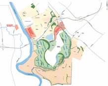
We were part of the discussion with the Sierra Club and got our first feedback on our blog. We had two main requests: post our slides from the presentation and make our overall map "enlargeable". Neither of those is real easy for novice bloggers, but a recent repeat of one request by Dr. Tufford, has spurred us to figure out a work-around. First the easy one: attached below is the same picture as our "Total Property" picture. We believe that by posting it here too, you can click on it and enlarge it. A whole Power Point slide show is taking more thought (the "convert it to Flash" method does not really preserve it). Thanks


2 comments:
More maps of proposed artificial wetlands
I attended the Sierra Club Meeting on March 19, 2007 and have created a few temporary mapping applications to address some of the concerns about what spatial information is available. These are available at Spatial Information for the Proposed Artificial Wetlands: Columbia, SC
These are only temporarily available unless Columbia Venture or another organization would like to host this information.
Thanks. I'm not sure how we would host them here on blogger. I will look.
Post a Comment